Clarity across your whole property
See livestock, paddocks and activity in one live, connected map. Bringing land, livestock and work together, online or offline.

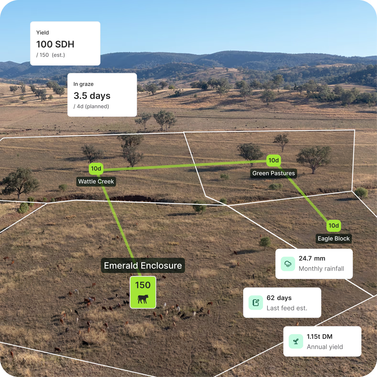
Feed position, recovery time, stocking rate and rainfall move together. Seeing them in one place keeps you working from what’s happening now, not from memory.

See paddocks, mobs, infrastructure and movements in one live map updated as you work, online or offline.

Link grazing history, pasture data and livestock performance directly to each paddock, so every move reflects the bigger picture.

Everyone works from the same live map, no outdated paper charts, no conflicting versions, no guesswork.
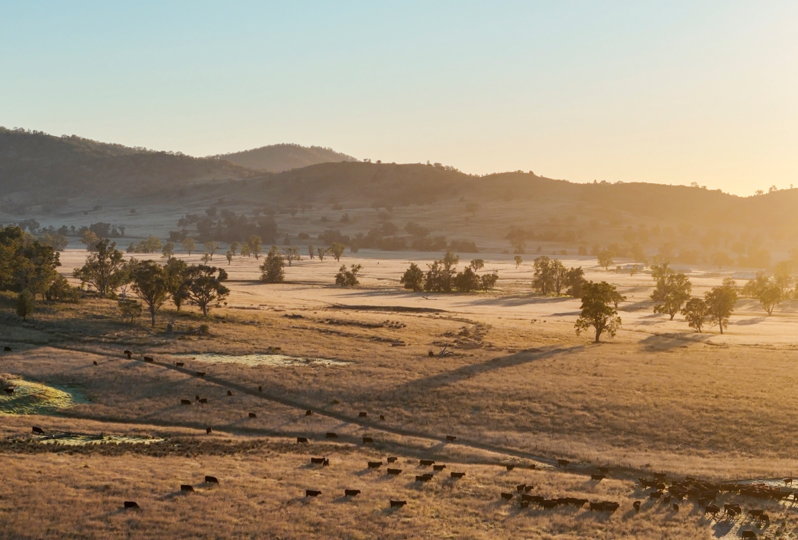
Paper maps get lost. Whiteboards get erased.The decisions made in a season; grazes, paddock changes, task activity, shape what happens next.
A live digital map builds a permanent record of paddocks, livestock movements, grazes, recovery periods, task completion and infrastructure changes, so you can see how your property has evolved and make future decisions with context.
See the patterns. Measure the progress. Know what made the difference.
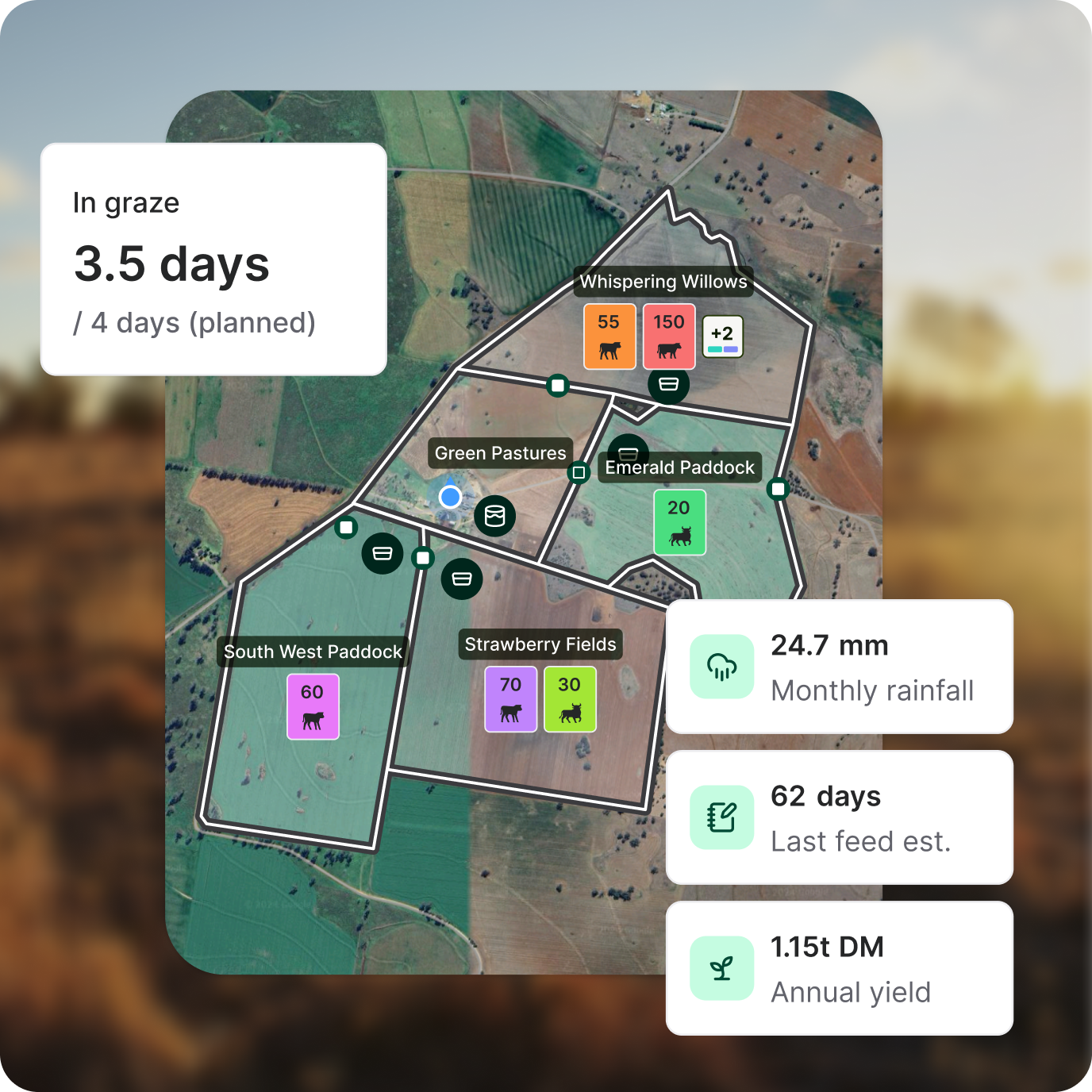
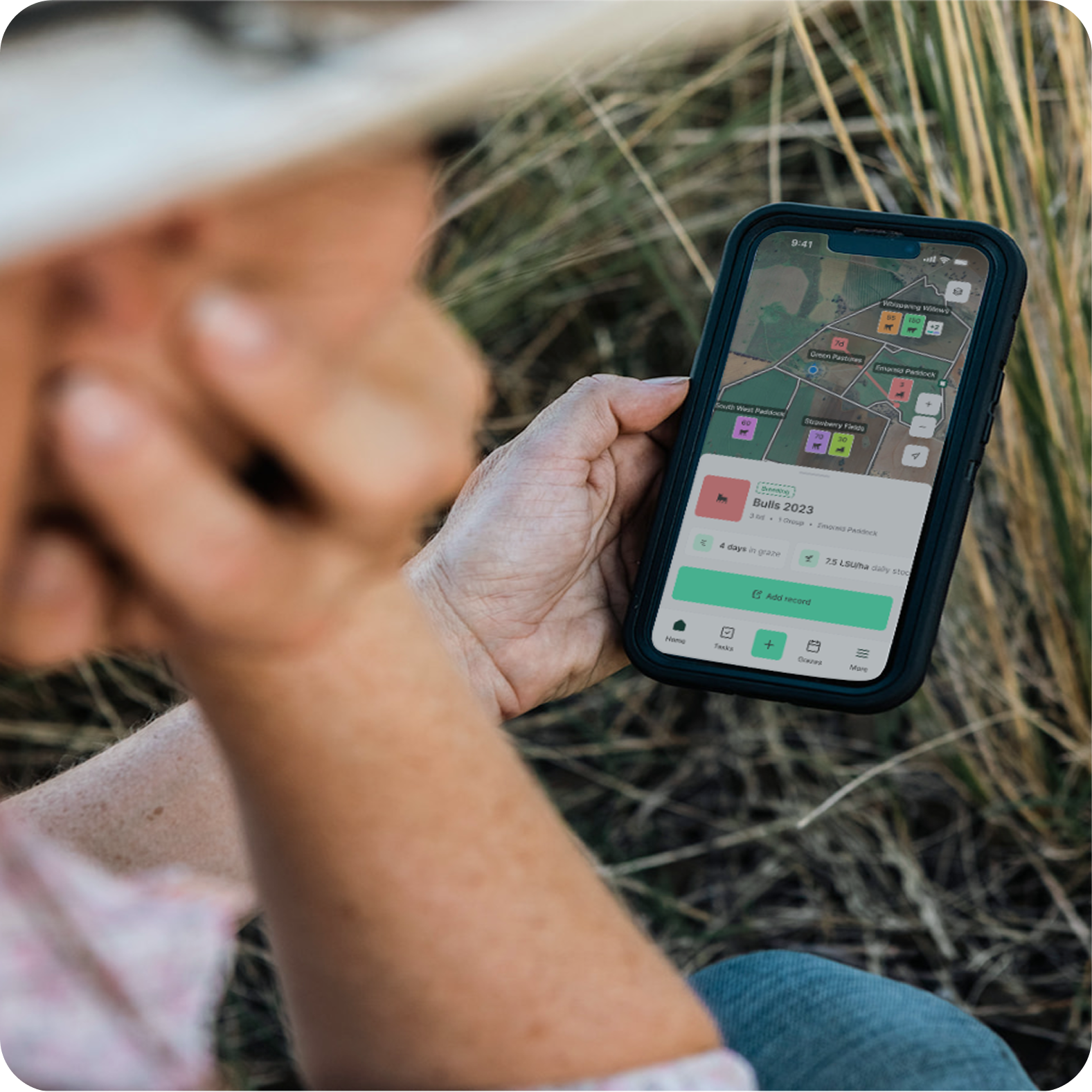
View paddock boundaries, infrastructure, water points, and grazing activity in one clean interface.

See which mobs are in which paddocks, manually create mob moves and see it on the map up to their next 5 moves.
From mobile, know exactly where you are located on the property using your live GPS location.

Access graze dates, rest periods, pasture performance, and historical notes tied directly to the map.

Record the exact location of repairs, treatments, pasture observations and water checks. Save time hunting them down later.

Use paddock and livestock records to guide rotation timing, pasture recovery and stocking decisions.
Learn more


Back your instinct with clear data — match the right class and size to your country and trade, breed, or agist with confidence.
Learn more

Get live access to livestock, land and operational data online or offline, across your devices, so you can make confident decisions wherever the day takes you.
Learn more

Centralise daily operations into one clear system that is accessible from paddock to office.
Learn more

Track rainfall data and paddock conditions to manage your landscape with confidenence in every season, from the wet to the dry.


Connect your live operational data, partners see not just where things are but what’s happened across seasons.
Learn moreStart with atlas grazing today
Bring paddocks, livestock, grazes and infrastructure into one live, connected map, built for real-world grazing.


.png)
.png)
.png)
.png)
.png)


